Janapada
Kuru
A polity of the later Vedic period in the upper Ganga–Yamuna region, which later Vedic texts associate with the codification of ritual and early forms of kingship.
The Map Check
Geographic extent
Largest recorded extent, from Cliopatria (Seshat Global History Databank, CC BY 4.0) — drawn as published. Open the atlas to see how it changed over time. Points are the places Indophile uses to locate the polity.
Places that locate this polity
| Place | Role | Counted |
|---|---|---|
| Hastinapura (in tradition) | capital | whole period |
| Kurukshetra | region named in texts | whole period |
The Historical Record
The historical record
DebatedInscriptions, texts, coins and other primary sources
Evidence for the Kuru polity comes almost entirely from Vedic texts. Witzel argued that the Kuru realm was the setting for the collection and arrangement of much of the Vedic corpus. Its relation to the epic tradition of the Mahabharata is a matter of literary history, not established political history.
SourcesWitzel 1995
Connected to Kuru
The wider world of this polity
Panchala
A janapada east of the Kurus in the Ganga–Yamuna doab, later divided into northern and southern Panchala.
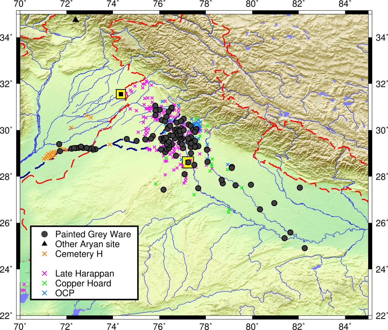
Painted Grey Ware Culture
An Iron Age archaeological culture of the Ganga–Yamuna plain, named after its fine grey pottery with black painted designs.
Hastinapura
A mound in the upper Ganga valley with Painted Grey Ware levels, excavated by B. B. Lal in 1950–52 and associated in tradition with the Kurus.
Eastward shift of the Vedic heartland (model)
Schematic: the centre of Vedic text production moves from the Punjab and the Kuru country in the earlier texts to Kosala and Videha in the later ones. A story in the Shatapatha Brahmana has Videgha Mathava carry the sacrificial fire east to the river Sadanira. This is a shift in where texts were composed and whose kings patronised them; how far people moved with it is debated.
Sources & Further Reading
Sources & further reading
- journal articleWitzel, M. (1995). Early Sanskritization: Origins and Development of the Kuru State. Electronic Journal of Vedic Studies 1(4).
- bookSingh, U. (2008). A History of Ancient and Early Medieval India: From the Stone Age to the 12th Century. Pearson Longman.